
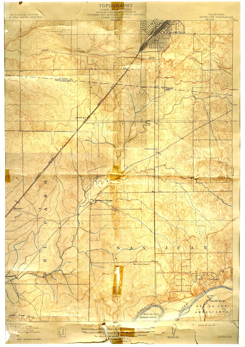
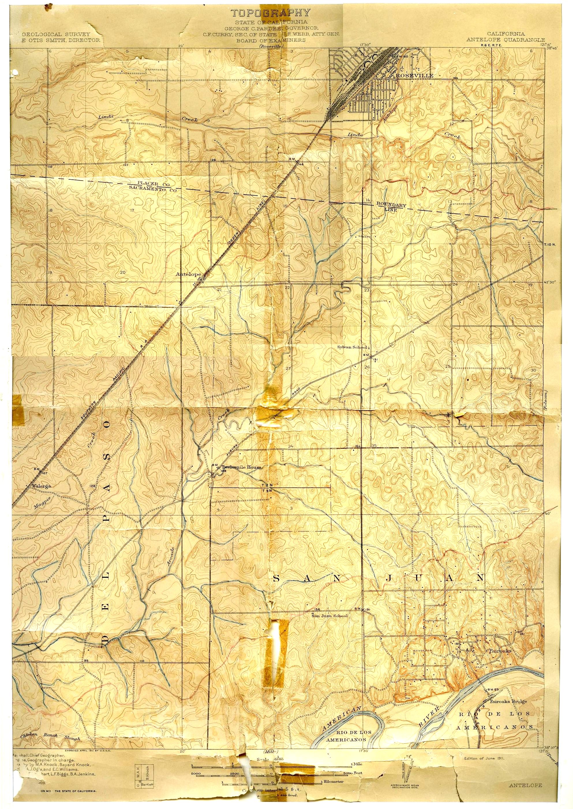
In our Old Maps section on this website, we have an annotated section of the 1911 USGS Antelope Quadrangle map which shows Fair Oaks as it really existed in that year. Members of the Fair Oaks Historical Society used this map to attempt to identify the location of as many homes as possible. The map is variously referred to as the 1908 map (when the survey was done), the 1909 map (when the map was published) and the 1911 map (the edition shown), but as far as we know, they're all the same map.
Meg Smart, one of the identification team members, has provided us with the original full map, for which we are very grateful. We'll include the screen size map below, but for those of you who want original detail we'll include a link to the full sized image. The map was taped together, and we had to scan the original in four sections and then piece the images back together on the computer, so there are some slightly offset roads at the margins.
The small squares on the map are structures, and as you can see, there weren't many in that year except in the flourishing settlement of Fair Oaks and the Roseville railroad yard.
1911 map - Full size image (1.5 mb)