Fair Oaks Historical Society
Virtual Walking Tour
Virtual Walking Tour
Stop 4 - Bridge Street
You’re standing just behind the yellow pedestrian walkway marker on the sidewalk facing south, right where the red “X” is.
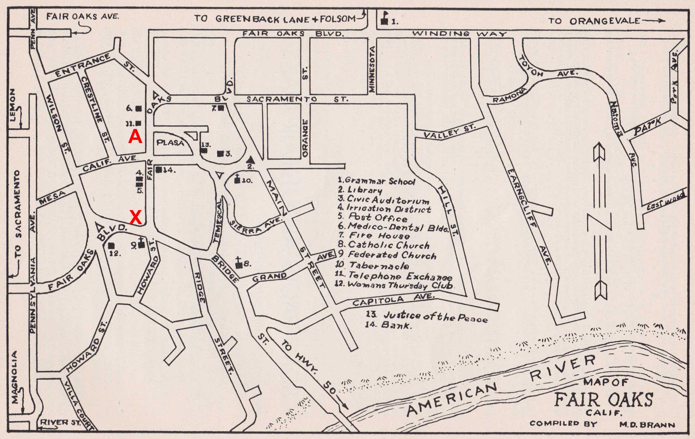
It’s hard to visualize the Fair Oaks Village before the Sunrise Bridge and Sunrise Blvd were constructed, but we’ll give it a shot. Follow us on the 1947 map at left to see what Fair Oaks looked like from 1902 to 1954.
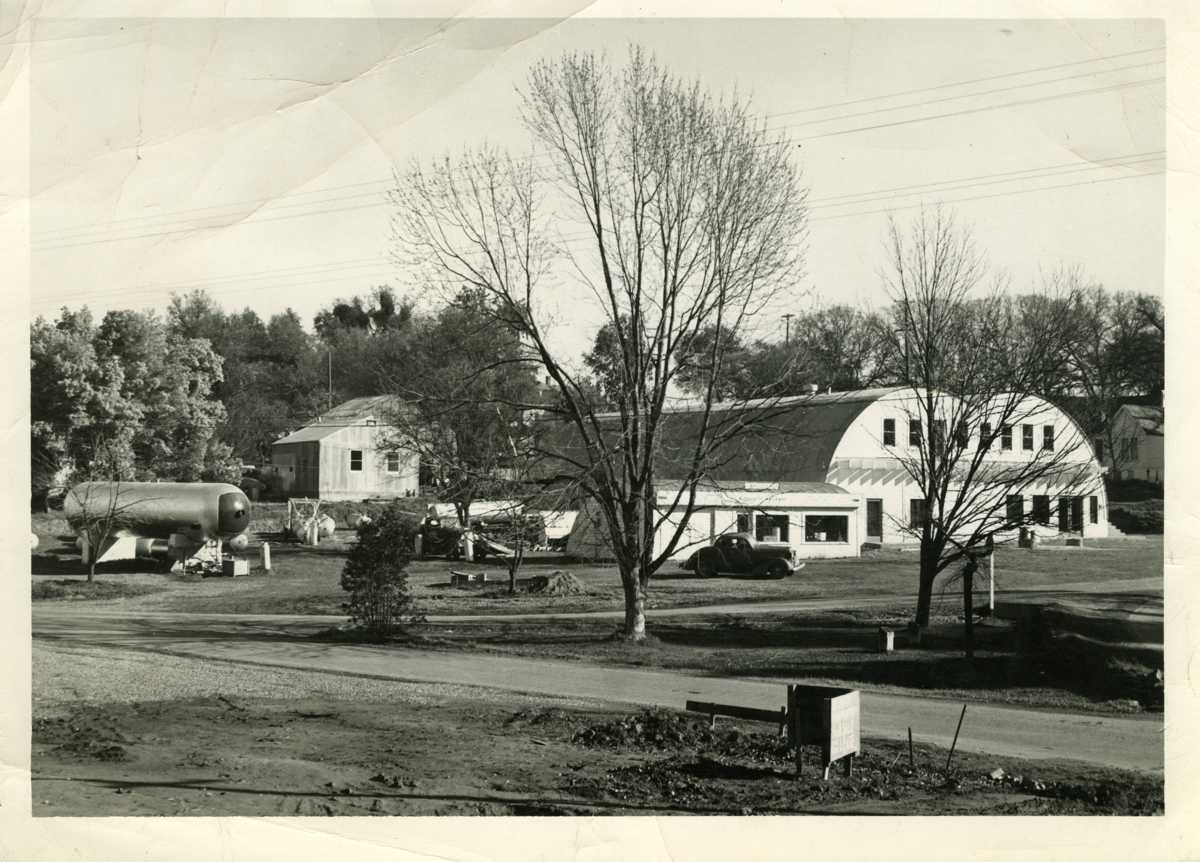
You can see the old Fair Oaks Bridge at the bottom middle of the map, the only entrance to the Village on the south. Autos, wagons and the Fair Oaks Stage would drive from the railroad station up Bridge Street (directly across from you) and into town (A). The main street was then named Howard Street. The diagonal street to the left was Wilson Street, and was torn up to be replaced by Sunrise Blvd. Howard Street curves south and then west going past the Fair Oaks Feed and Fuel Quonset hut buildings (currently the minimart block to California Ave). There are remnants of Howard Street behind the Sports Bar and across Sunrise just south of the current Fair Oaks Blvd crossing.
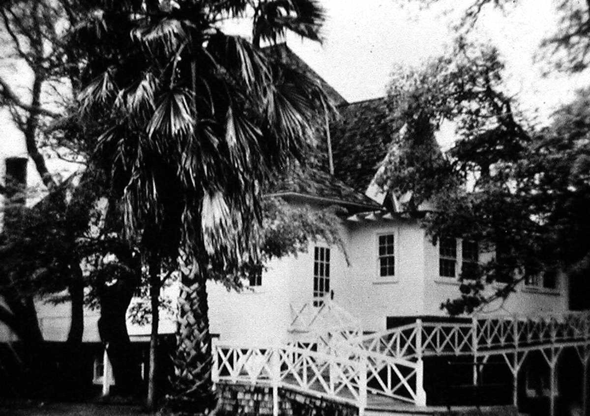
On the hill to the south were the Federated Church and the Woman's Thursday Club building, both torn down about the time Sunrise Blvd was built in the 1950's but clearly marked on the 1947 map.
Next